
Fichier:South Korea-South Gyeongsang.svg

Taille de cet aperçu PNG pour ce fichier SVG : 426 × 599 pixels. Autres résolutions : 170 × 240 pixels | 341 × 480 pixels | 546 × 768 pixels | 728 × 1 024 pixels | 1 456 × 2 048 pixels | 509 × 716 pixels.
Fichier d’origine (Fichier SVG, nominalement de 509 × 716 pixels, taille : 59 kio)
Description
| Description |
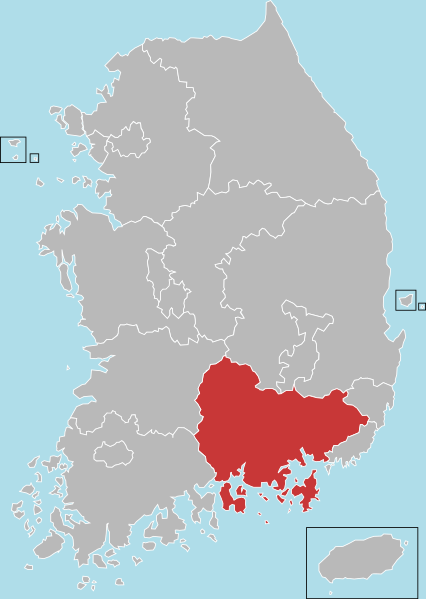
English: Locator map of South Gyeongsang |
| Date | |
| Source | File:Administrative divisions map of South Korea.svg (Dmthoth) |
| Auteur | Dmthoth |
Conditions d’utilisation
Moi, en tant que détenteur des droits d’auteur sur cette œuvre, je la publie sous les licences suivantes :
Ce fichier est disponible selon les termes de la licence Creative Commons Attribution – Partage dans les Mêmes Conditions 3.0 (non transposée).
- Vous êtes libre :
- de partager – de copier, distribuer et transmettre cette œuvre
- d’adapter – de modifier cette œuvre
- Sous les conditions suivantes :
- paternité – Vous devez donner les informations appropriées concernant l'auteur, fournir un lien vers la licence et indiquer si des modifications ont été faites. Vous pouvez faire cela par tout moyen raisonnable, mais en aucune façon suggérant que l’auteur vous soutient ou approuve l’utilisation que vous en faites.
- partage à l’identique – Si vous modifiez, transformez, ou vous basez sur cette œuvre, vous devez distribuer votre contribution sous la même licence ou une licence compatible avec celle de l’original.

|
Vous avez la permission de copier, distribuer et modifier ce document selon les termes de la GNU Free Documentation License version 1.2 ou toute version ultérieure publiée par la Free Software Foundation, sans sections inaltérables, sans texte de première page de couverture et sans texte de dernière page de couverture. Un exemplaire de la licence est inclus dans la section intitulée GNU Free Documentation License. |
Vous pouvez choisir l’une de ces licences.
Historique du fichier
Cliquer sur une date et heure pour voir le fichier tel qu'il était à ce moment-là.
| Date et heure | Vignette | Dimensions | Utilisateur | Commentaire | |
|---|---|---|---|---|---|
| actuel | 4 juillet 2023 à 04:36 | | 509 × 716 (59 kio) | Nv7801 | First class administrative division change. |
| 7 février 2013 à 11:02 |  | 509 × 716 (56 kio) | ASDFGH | == {{int:filedesc}} == {{Information |Description={{en|Locator map of South Gyeongsang}} |Source=File:Administrative divisions map of South Korea.svg (Dmthoth) |Author=Dmthoth |Date=2013-02-07 |Permission= |other_... |
Utilisation du fichier
Aucune page n’utilise ce fichier.
Usage global du fichier
Les autres wikis suivants utilisent ce fichier :
- Utilisation sur ar.wikipedia.org
- Utilisation sur cdo.wikipedia.org
- Utilisation sur cs.wikipedia.org
- Utilisation sur en.wikipedia.org
- South Gyeongsang Province
- Jinhae-gu
- Changwon
- Geoje
- Gimhae
- Jinju
- Miryang
- Sacheon
- Tongyeong
- Yangsan
- Changnyeong County
- Geochang County
- Goseong County, South Gyeongsang
- Hadong County
- Haman County
- Hapcheon County
- Hamyang County
- Namhae County
- Sancheong County
- Uiryeong County
- Template:South Gyeongsang
- Uichang-gu
- Seongsan-gu
- Masanhoewon-gu
- Masanhappo-gu
- Hwawangsan
- User:Jsyjj92/sandbox
- User:Zsj.engl300/sandbox
- List of cities and counties of South Gyeongsang Province
- Utilisation sur en.wikivoyage.org
Voir davantage sur l’utilisation globale de ce fichier.