
Fichier:BlankEurope.png

Taille de cet aperçu : 595 × 599 pixels. Autres résolutions : 238 × 240 pixels | 477 × 480 pixels | 762 × 768 pixels | 1 236 × 1 245 pixels.
Fichier d’origine (1 236 × 1 245 pixels, taille du fichier : 78 kio, type MIME : image/png)

|
Une version vectorielle de cette image existe, dans le format « SVG ». Si elle n’est pas inférieure, elle devrait être utilisée à la place de la présente version pour des affichages en plus grandes dimensions ou nécessitant une meilleure résolution.
File:BlankEurope.png → File:Blank map of Europe (with disputed regions).svg
Pour plus d’informations sur les images vectorielles, consultez la page de transition de Commons vers le format SVG. Voir aussi les informations à propos de la manière dont le logiciel MediaWiki gère les images au format SVG. |
.svg) |
Description
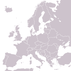
A blank political map of Europe extracted from Image:European Union member states by number of houses.png. +Hexagon1 (t) 04:47, 26 November 2006 (UTC)
Other versions: if you wish to use a map to show historical information before 2008, use Image:BlankEurope-BeforeKosovo.png
Conditions d’utilisation

|
Vous avez la permission de copier, distribuer et modifier ce document selon les termes de la GNU Free Documentation License version 1.2 ou toute version ultérieure publiée par la Free Software Foundation, sans sections inaltérables, sans texte de première page de couverture et sans texte de dernière page de couverture. Un exemplaire de la licence est inclus dans la section intitulée GNU Free Documentation License. |
| Ce fichier est disponible selon les termes de la licence Creative Commons Attribution – Partage dans les Mêmes Conditions 3.0 (non transposée). | ||
| ||
| Ce bandeau de licence a été ajouté à ce fichier dans le cadre de la procédure de mise à jour des licences des images sous GFDL. |
Historique du fichier
Cliquer sur une date et heure pour voir le fichier tel qu'il était à ce moment-là.
| Date et heure | Vignette | Dimensions | Utilisateur | Commentaire | |
|---|---|---|---|---|---|
| actuel | 26 septembre 2022 à 13:31 | | 1 236 × 1 245 (78 kio) | BlackShadowG | Reverted to version as of 14:55, 27 October 2008 (UTC) |
| 23 février 2009 à 22:40 |  | 1 236 × 1 245 (78 kio) | Avala | ||
| 27 octobre 2008 à 14:55 |  | 1 236 × 1 245 (78 kio) | Quilbert | Reverted to version as of 05:53, 5 April 2008 – there is already Image:BlankEurope-BeforeKosovo.png | |
| 24 octobre 2008 à 18:13 |  | 1 236 × 1 245 (78 kio) | Avala | ||
| 5 avril 2008 à 05:53 |  | 1 236 × 1 245 (78 kio) | Hoshie | redid microstates, beefed up Spanish N. Africa, SBAs, and Gibraltar | |
| 25 février 2008 à 18:42 |  | 1 236 × 1 245 (78 kio) | Hoshie | fixed Gibraltar, Ceuta and Melilla, and the SBAs | |
| 24 février 2008 à 02:39 |  | 1 236 × 1 245 (78 kio) | Hoshie | Added Kosovo since it has been internationally recognized | |
| 3 janvier 2008 à 22:40 |  | 1 236 × 1 245 (78 kio) | Hoshie | Re-drew ESBA and WSBA with circles until I study the CIA maps, boundary between Gibraltar and Spain. | |
| 26 novembre 2006 à 04:47 |  | 1 236 × 1 245 (44 kio) | Happenstance | A blank map of Europe extracted from Image:European Union member states by number of houses.png. ~~~~ |
Utilisation du fichier
Aucune page n’utilise ce fichier.
Usage global du fichier
Les autres wikis suivants utilisent ce fichier :
- Utilisation sur de.wiktionary.org
- Utilisation sur hu.wikipedia.org
- Utilisation sur incubator.wikimedia.org
- Utilisation sur it.wiktionary.org
- Utilisation sur sl.wiktionary.org
- Utilisation sur uk.wikipedia.org