
Fichier:Switzerland-map.png
Taille de cet aperçu : 800 × 517 pixels. Autres résolutions : 320 × 207 pixels | 640 × 413 pixels | 1 024 × 661 pixels | 1 280 × 827 pixels | 2 453 × 1 584 pixels.
Fichier d’origine (2 453 × 1 584 pixels, taille du fichier : 1,07 Mio, type MIME : image/png)
Description
| Description |
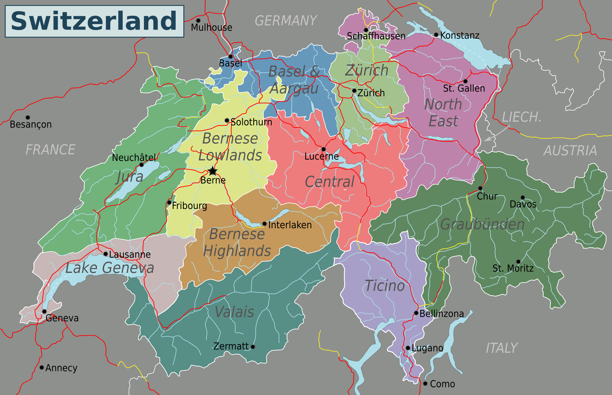
English: Map of Switzerland (PNG). Nota Bene: the regions displayed in this map are not official administrative divisions.
Cette PNG image matricielle a été créée avec Inkscape . |
| Date | |
| Source | Travail personnel based on Suisse cantons.svg by Pymouss44, Switzerland regions.svg by Stefan Ertmann and work by OpenStreetMap.org contributors. |
| Auteur | Globe-trotter |
| Autres versions | Inkscape SVG |
Conditions d’utilisation
Ce fichier est sous la licence Creative Commons Attribution – Partage dans les Mêmes Conditions 4.0 International.
- Vous êtes libre :
- de partager – de copier, distribuer et transmettre cette œuvre
- d’adapter – de modifier cette œuvre
- Sous les conditions suivantes :
- paternité – Vous devez donner les informations appropriées concernant l'auteur, fournir un lien vers la licence et indiquer si des modifications ont été faites. Vous pouvez faire cela par tout moyen raisonnable, mais en aucune façon suggérant que l’auteur vous soutient ou approuve l’utilisation que vous en faites.
- partage à l’identique – Si vous modifiez, transformez, ou vous basez sur cette œuvre, vous devez distribuer votre contribution sous la même licence ou une licence compatible avec celle de l’original.
Historique du fichier
Cliquer sur une date et heure pour voir le fichier tel qu'il était à ce moment-là.
| Date et heure | Vignette | Dimensions | Utilisateur | Commentaire | |
|---|---|---|---|---|---|
| actuel | 4 mai 2016 à 05:40 | | 2 453 × 1 584 (1,07 Mio) | Drat70 | Reverted to version as of 11:04, 16 May 2015 (UTC) as this file is also used by other pages |
| 4 mai 2016 à 05:38 |  | 2 462 × 1 590 (1,04 Mio) | Drat70 | Changed some of the regions as per discussion on the wikivoyage Switzerland talk page. | |
| 16 mai 2015 à 11:04 |  | 2 453 × 1 584 (1,07 Mio) | Globe-trotter | {{Information |description={{en|1=Map of Switzerland (PNG).}} {{Created with Inkscape|IMPORTANT=1}} |date=2015-05-16 |source={{own}} based on Suisse cantons.svg by Pymouss44, [[:File:Switzerland regions.s... |
Utilisation du fichier
Aucune page n’utilise ce fichier.
Usage global du fichier
Les autres wikis suivants utilisent ce fichier :
- Utilisation sur en.wikivoyage.org
- Utilisation sur fa.wikivoyage.org
- Utilisation sur hi.wikibooks.org