
Fichier:Lebanon location map.svg

Taille de cet aperçu PNG pour ce fichier SVG : 521 × 600 pixels. Autres résolutions : 208 × 240 pixels | 417 × 480 pixels | 667 × 768 pixels | 889 × 1 024 pixels | 1 779 × 2 048 pixels | 992 × 1 142 pixels.
Fichier d’origine (Fichier SVG, nominalement de 992 × 1 142 pixels, taille : 219 kio)

|
Les frontières de cette carte représentent la situation de facto. Il s'agit juste de l'un des quelques points de vue différents sur le sujet (voir COM:NPOV). |
Description
| Description |
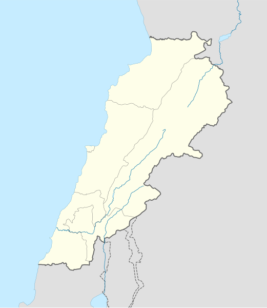
Deutsch: Positionskarte des Libanon
Quadratische Plattkarte, N-S-Streckung 115 %. Geographische Begrenzung der Karte:
English: Location map of Lebanon
Equirectangular projection, N/S stretching 115 %. Geographic limits of the map:
|
| Date | |
| Source |
own work, using
|
| Auteur | NordNordWest |
| Autres versions | Œuvres dérivées de ce fichier : Israel and surroundings location map.svg |

|
Cette carte a été créée ou améliorée dans le Kartenwerkstatt (Atelier cartographique allemand). Vous pouvez également y proposer des cartes à améliorer.
|
Conditions d’utilisation
Moi, en tant que détenteur des droits d’auteur sur cette œuvre, je la publie sous les licences suivantes :

|
Vous avez la permission de copier, distribuer et modifier ce document selon les termes de la GNU Free Documentation License version 1.2 ou toute version ultérieure publiée par la Free Software Foundation, sans sections inaltérables, sans texte de première page de couverture et sans texte de dernière page de couverture. Un exemplaire de la licence est inclus dans la section intitulée GNU Free Documentation License. |
Ce fichier est disponible selon les termes de la licence Creative Commons Attribution – Partage dans les Mêmes Conditions 3.0 (non transposée).
- Vous êtes libre :
- de partager – de copier, distribuer et transmettre cette œuvre
- d’adapter – de modifier cette œuvre
- Sous les conditions suivantes :
- paternité – Vous devez donner les informations appropriées concernant l'auteur, fournir un lien vers la licence et indiquer si des modifications ont été faites. Vous pouvez faire cela par tout moyen raisonnable, mais en aucune façon suggérant que l’auteur vous soutient ou approuve l’utilisation que vous en faites.
- partage à l’identique – Si vous modifiez, transformez, ou vous basez sur cette œuvre, vous devez distribuer votre contribution sous la même licence ou une licence compatible avec celle de l’original.
Vous pouvez choisir l’une de ces licences.
Historique du fichier
Cliquer sur une date et heure pour voir le fichier tel qu'il était à ce moment-là.
| Date et heure | Vignette | Dimensions | Utilisateur | Commentaire | |
|---|---|---|---|---|---|
| actuel | 22 août 2008 à 20:31 | | 992 × 1 142 (219 kio) | NordNordWest | |
| 22 août 2008 à 20:08 |  | 992 × 1 141 (219 kio) | NordNordWest | {{Information |Description= {{de|Positionskarte des Libanon}} Quadratische Plattkarte, N-S-Streckung 115 %. Geographische Begrenzung der Karte: * N: 34.9° N * S: 32.8° N * W: 34.8° O * O: 36.9° O {{en|Location map of [[:en:Lebanon|Leba |
Utilisation du fichier
Aucune page n’utilise ce fichier.
Usage global du fichier
Les autres wikis suivants utilisent ce fichier :
- Utilisation sur af.wikipedia.org
- Utilisation sur als.wikipedia.org
- Utilisation sur an.wikipedia.org
- Utilisation sur ar.wikipedia.org
- دير مار أنطونيوس قزحيا
- قالب:خريطة مواقع لبنان
- عرسال
- نهر إبراهيم (نهر)
- قائمة مواقع التراث العالمي في لبنان
- تفجيرات بلدة القاع اللبنانية 2016
- قرار مجلس الأمن التابع للأمم المتحدة رقم 490
- مجزرة حولا
- إمدادات المياه والصرف الصحي في لبنان
- دير سيدة اللويزة
- دير سيدة راس بعلبك
- دير رقاد السيدة حماطورة
- مار ميماس (دير)
- دير مار قبريانوس ويوستينا
- Utilisation sur arz.wikipedia.org
- Utilisation sur az.wikipedia.org
- Utilisation sur ba.wikipedia.org
- Utilisation sur be-tarask.wikipedia.org
- Utilisation sur be.wikipedia.org
Voir davantage sur l’utilisation globale de ce fichier.